

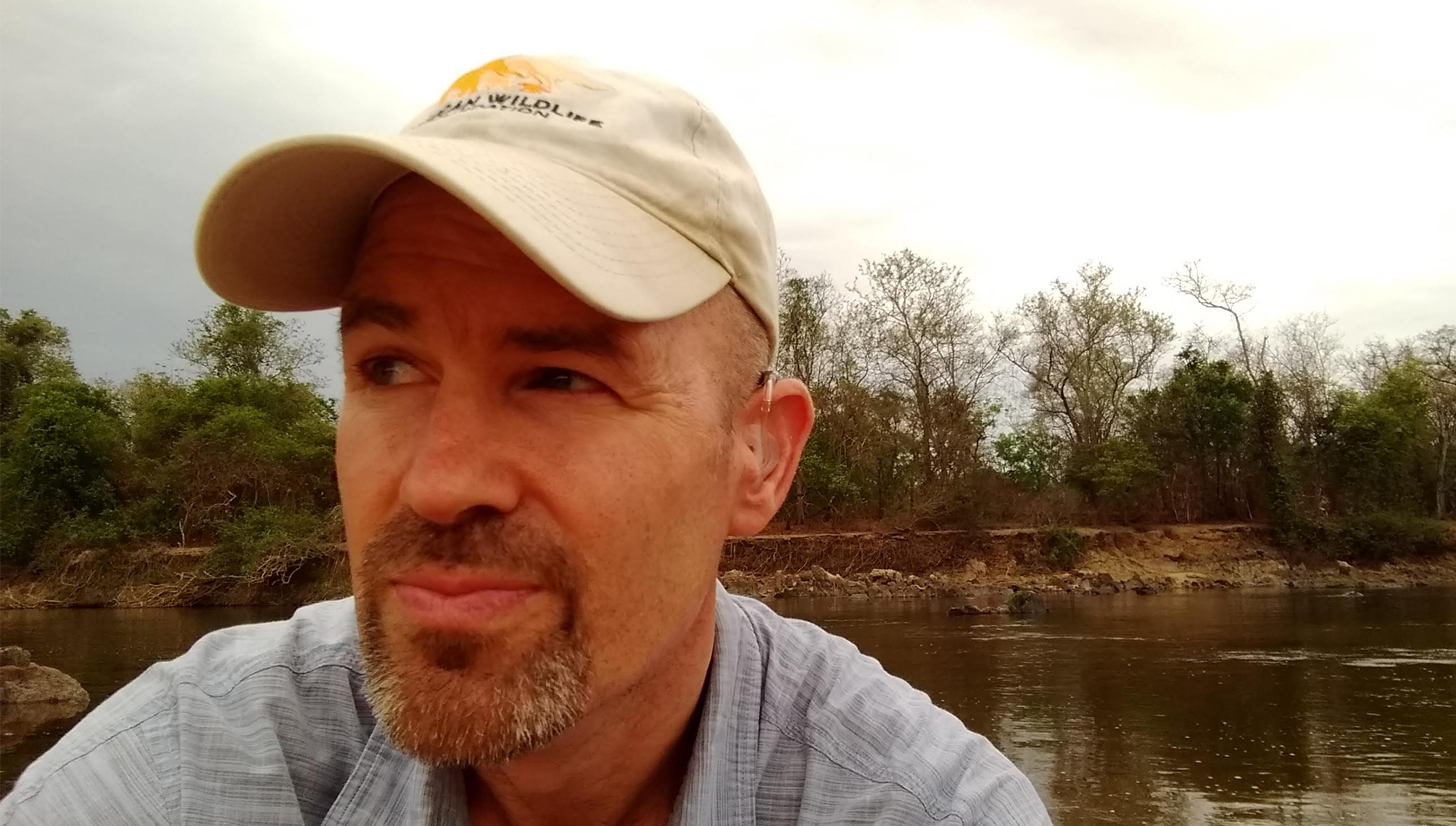
AWF’s Senior Director of Conservation Geography David Williams.
Nearly half of the world’s 20 fastest-growing economies in 2025 were projected to be in Africa. As roads, railways, dams, and development reshape the continent, a critical question emerges: how can Africa pursue economic growth while protecting the biodiversity and natural systems that sustain it? Ahead of the 17th Conference of the Parties to the Convention on Biological Diversity (CBD COP17), taking place from 19–30 October 2026 in Yerevan, Armenia, we sat down with David Gerard Williams, Senior Director of Conservation Geography at the African Wildlife Foundation (AWF), to explore how geospatial intelligence can help African leaders turn biodiversity commitments into action and plan for a future where conservation and development coexist.
For AWF, leadership in geospatial intelligence is not defined by the maps it produces, but by what the information enables, who can use it, and how that can scale across Africa.
The distinction is important: technology is only part of the solution. Geospatial intelligence becomes valuable when it helps people make better decisions.
At Cameroon’s Dja Faunal Reserve, AWF and Esri‘s Degradation Dashboard flagged significant road expansion in the reserve’s buffer zone in 2023. By combining predictions of potential illegal forest activity with high-resolution satellite imagery, the dashboard provided an early warning that prompted Cameroon’s wildlife authority and UNESCO to engage the surrounding community and curb further encroachment.
In Tanzania’s Vidunda catchment, AWF’s Conservation Geography team used spatial analysis to identify forest-restoration sites most likely to sustain clean-water flows to downstream users, including smallholder farmers and the commercial sugar sector. They prioritised areas such as steeper slopes and the edges of existing montane forests, identifying opportunities to support water security while restoring wildlife habitat.
These examples demonstrate how AWF has used GIS to identify conservation threats while directing restoration towards areas where it can benefit both people and nature.
Making Conservation and Development Coexist
As African countries expand infrastructure and agricultural production, decisions about where development takes place will have lasting consequences for biodiversity. Roads can connect communities and markets, but they can also fragment habitats and disrupt wildlife movement.
Geospatial intelligence helps planners assess ecological priorities alongside development needs before decisions are finalised. The Amboseli Ecosystem Geospatial Hub, developed with Kajiado County, puts every stakeholder on the same page, a shared public picture of ecological priorities, emerging threats and where the landscape is heading, so competing land use interests can be weighed against common evidence.
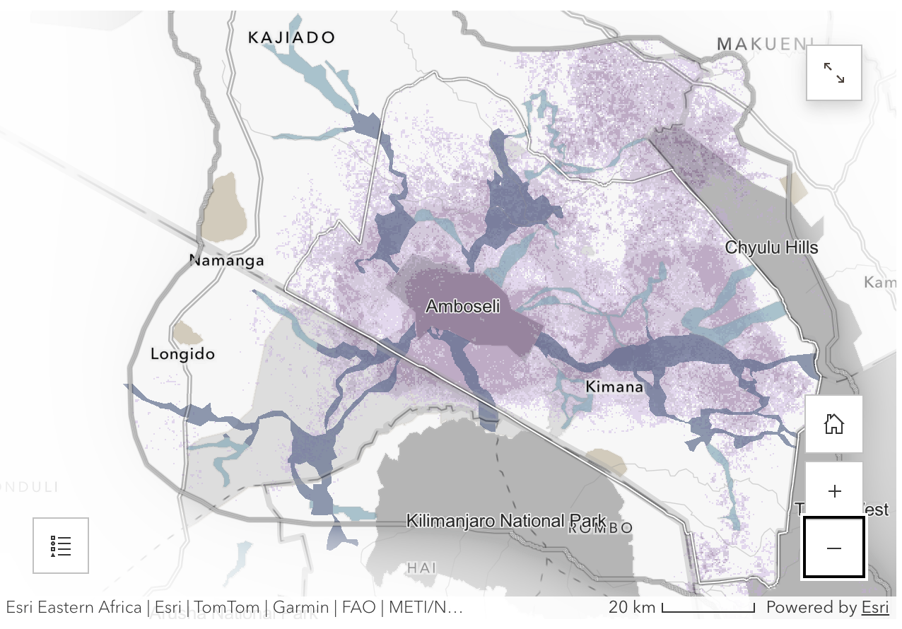
AWF modeled elephant habitat suitability in Amboseli National Park, highlighting areas critical for conservation amid growing habitat loss and human-elephant conflict.
Sustainable development and conservation can go hand in hand when planning accounts for critical habitats, wildlife corridors and the natural systems that provide clean water and sustain communities and economies. Achieving this requires conservation leaders who can interpret geospatial information, assess competing land-use priorities, and use evidence to inform decisions about how landscapes are planned and managed.
AWF’s Geospatial Leaders Fellowship invests in these leaders, equipping African conservation professionals with the technical expertise to harness geospatial tools and the leadership capabilities to translate insights into action. The fellowship helps participants influence not only how individual landscapes are managed, but also how their institutions approach conservation. Its strategic value lies in building a team of African professionals who champion evidence-based decision making within their organisations and across the wider conservation sector.
For this capacity to translate into broader conservation impact, individual leadership must be supported by strong professional networks and institutional systems. The Africa Protected Area Directors (APAD) network provides a pathway to extend this impact across the continent, connecting protected area leaders and reinforcing their capacity to apply evidence in adaptive, effective management. Through this network, the benefits of geospatial expertise can extend beyond individual fellows, supporting peer learning and wider uptake of evidence-based approaches across Africa’s protected areas.
AWF’s Conservation GeoHub model complements this leadership and network-based approach by providing the digital infrastructure to put geospatial information into practice. This model, built using Esri’s ArcGIS Hub technology, gives government partners and communities centralised access to maps, plans and dashboards that support conservation planning, monitoring, reporting and coordination.
From CBD Commitments to Action
The Kunming–Montreal Global Biodiversity Framework commits countries to conserving at least 30% of land and 30% of sea, restoring degraded ecosystems and improving land-use planning by 2030. Meeting these targets depends on reliable geospatial data that shows where action is needed and whether it is working. Delivering these commitments requires countries to know where important ecosystems are located, how they are changing, and whether conservation efforts are working.
GIS supports the entire process, from national planning and implementation, to monitoring, reporting, and adapting approaches. However, the availability of biodiversity-related geospatial data does not necessarily translate into meaningful influence on policy, investment, or conservation action.
As David explains, “The gap isn’t a shortage of data, it’s the last mile delivery.” Information must reach the people who can act on it, whether they are rangers, planners, policymakers or investors. Through Conservation GeoHubs, AWF is closing that last mile, working to make spatial data more accessible and to improve the visibility of African field-level biodiversity information.
In partnership with the African Leadership University’s School of Wildlife Conservation, AWF has co-developed the Wildlife Economies Decision and Investment Support Toolkit, which uses the GeoHub to bring ecological, social and financial information together to help governments and investors make informed decisions about financing the wildlife economy.
Geospatial Intelligence as a Strategic Asset
David Williams during a training session with park eco-guards. © Abiaz Rwamwiri
With infrastructure and economic activity expanding across Africa at an accelerating pace, the coming decade will be critical for the continent’s biodiversity. Meeting this moment requires sustained institutional commitment, investment in African geospatial talent, strong technology partnerships, and funding across the entire data pipeline.
For David, geospatial intelligence has earned its place everywhere from ranger’s field offices to the boardroom.
“Treat geospatial intelligence as a technical function, and you will ask for maps. Treat it as a strategic asset, and it will tell you which futures are possible and let you choose among them.”
GIS is not an end in itself, but a means of turning biodiversity commitments into action. AWF is already working to make geospatial intelligence more accessible and useful to African leaders, supporting decisions grounded in evidence and informed by the realities of their landscapes and communities. Ultimately, the power to shape Africa’s development pathways must rest with African leaders themselves.
Equipping decision-makers with reliable, relevant information can help bridge the gap between global biodiversity commitments and national action, ensuring that conservation and development advance together towards the 2030 global biodiversity targets.

