Close Menu
    Facebook X (Twitter) Instagram
    • Home
    • Contact Us
    • About Us
    • Privacy Policy
    • Terms Of Service
    • Advertisement
    Wednesday, July 29
    Facebook X (Twitter) Instagram Pinterest Vimeo
    ABS Africa TV
    • Breaking News
    • Trending
    • Africa News
    • World News
    • Features
    • Technology
    • Sports
    • Politics
    • More
      • Culture
      • Lifestyle
      • Travel
      • Business
      • Environment
      • Legal
      • Health
      • Cameroon
      • Ambazonia
      • AfroSingles
      • Environ/Climate
      • Editorial
      • The Leak Magazine
    • Donate
    Subscription
    ABS Africa TV
    Home»Africa News»Devastating European wildfires in maps
    Africa News

    Devastating European wildfires in maps

    Chris AnuBy Chris AnuJuly 27, 2026No Comments4 Mins Read
    Facebook Twitter Pinterest LinkedIn Tumblr Email
    Devastating European wildfires in maps
    Share
    Facebook Twitter LinkedIn Pinterest Email
    Post Views: 19

    Devastating European wildfires in maps – and how they’re being tackled
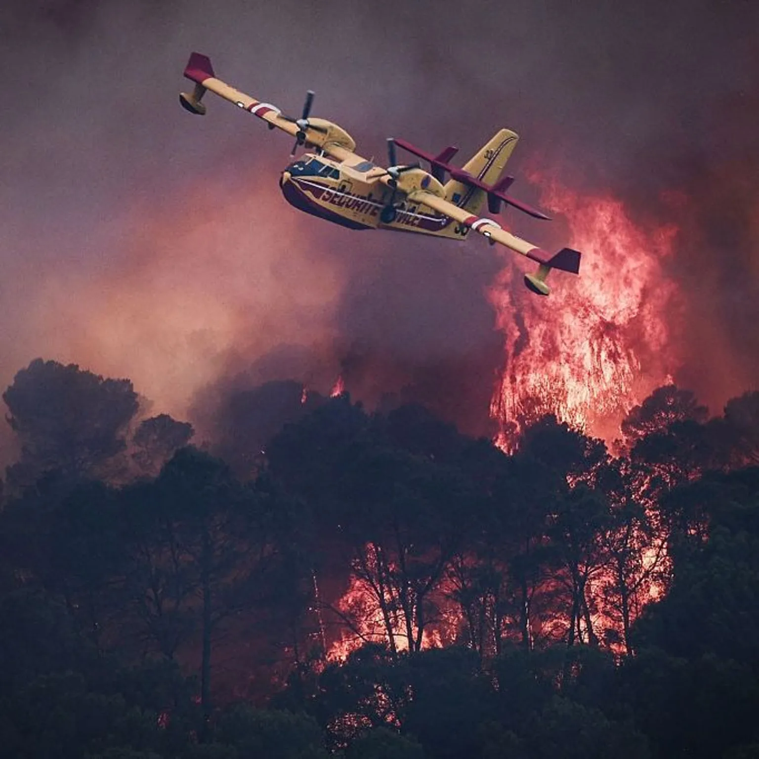
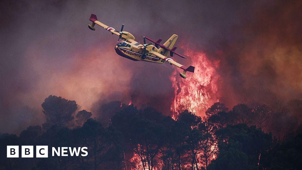
    AFP A small yellow airplane flies over red flames rising in smoke above dark trees.

    Wildfires are tearing through France and Spain, forcing more than 300,000 people to evacuate their homes.

    France has seen its worst wildfires in two decades, while officials in the Spanish capital Madrid say the fires are the worst the region has ever experienced.

    It follows a sweltering summer of heatwaves across Europe that have seen temperatures soar above 40C (104F) in many places.

    Three separate wildfires in the mountains outside Madrid have together burned about 297 sq miles (770 sq km), authorities estimate.
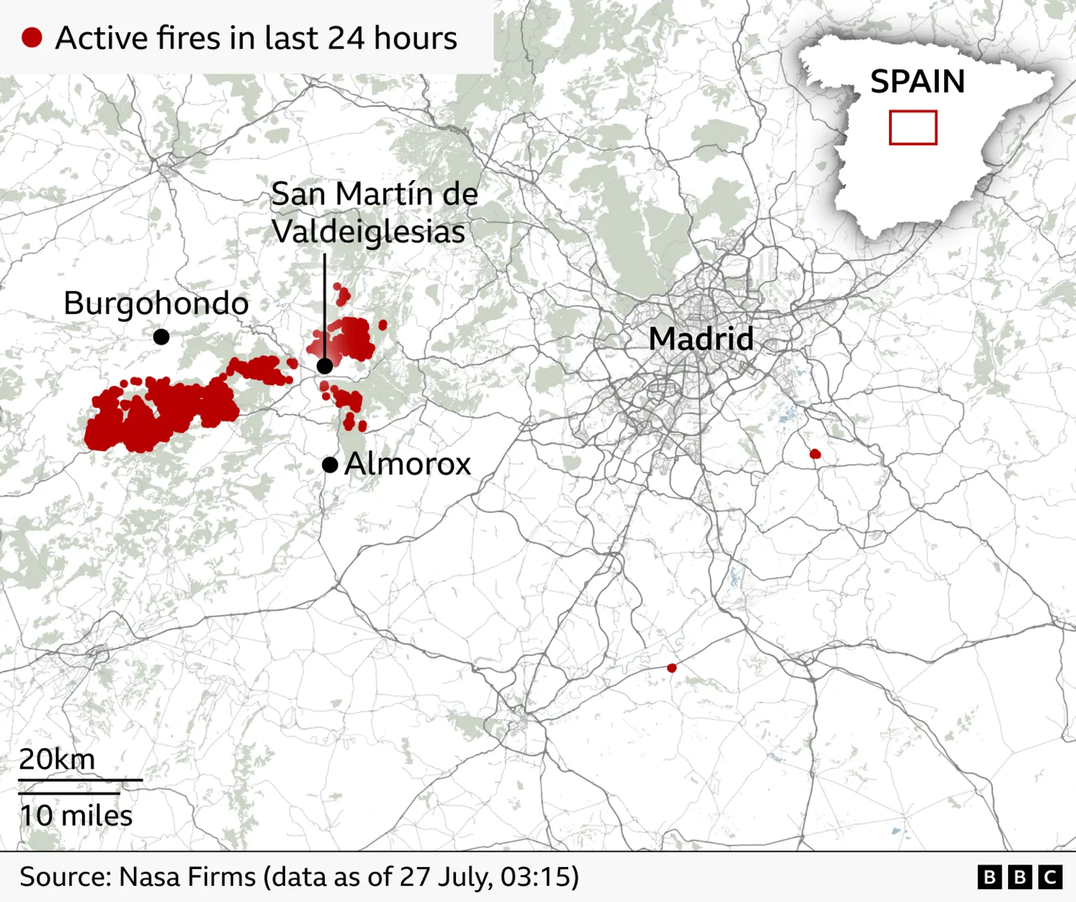
    A map shows the location of active fires in the last 24 hours west of Madrid, Spain.

    In France, the worst affected area is Gironde, around the city of Bordeaux, where more than 200,000 people have been forced from their homes.

    The blaze has spread rapidly, tearing through forests and fields in France’s famous wine region, and burning more than 162 sq miles (420 sq km) in less than four days – an area roughly four times the size of Paris.

    It is now just nine miles (15km) from the south of Bordeaux.
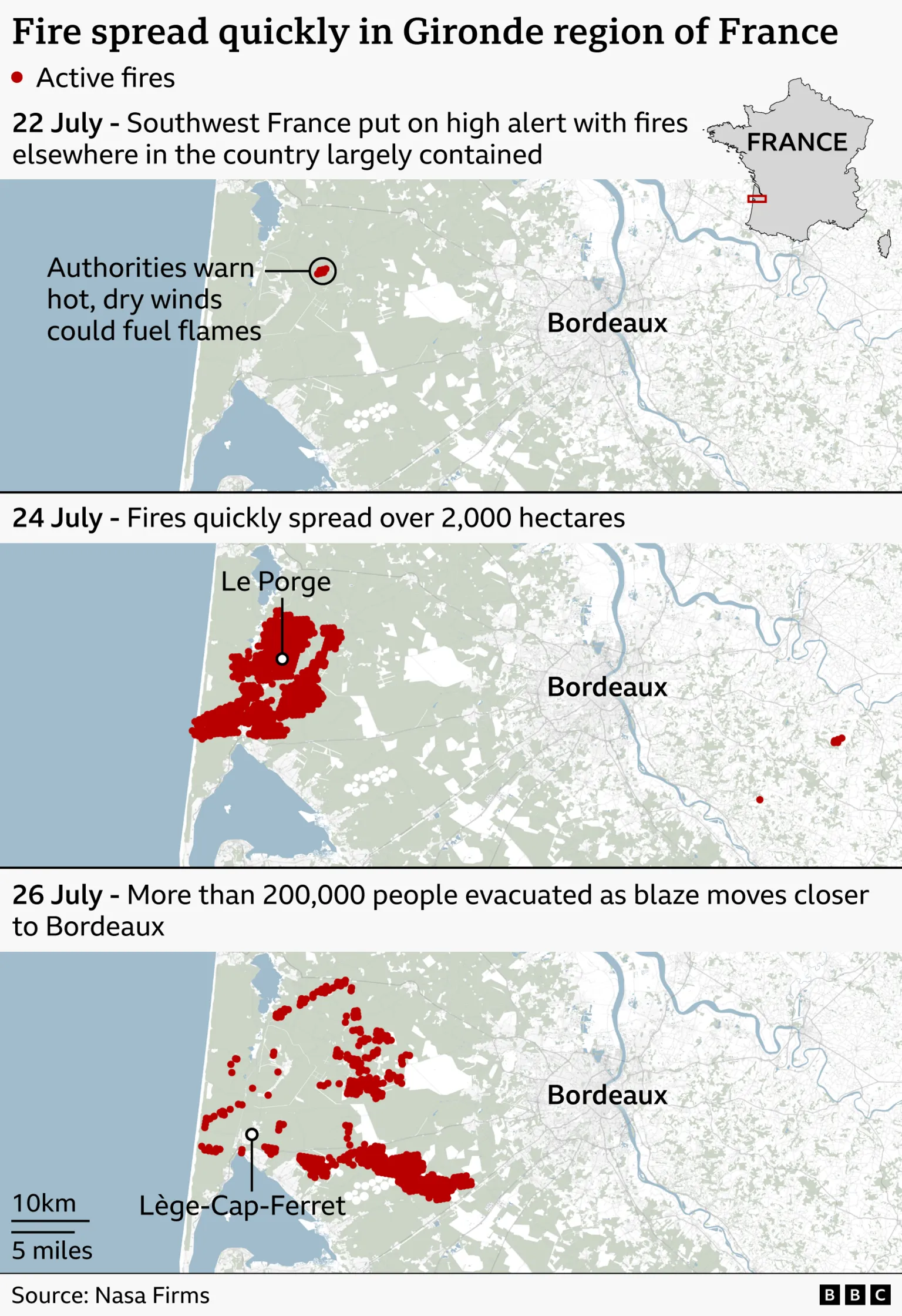
    Three maps show how fires spread quickly from a high alert warning that hot, dry winds could fuel flames on 22 July, to fires spreading to over 2,000 hectares on 24 July, then to more than 200,000 people evacuated by 26 July.

    The fires have also threatened a number of sensitive military and industrial sites in the area, including facilities that work on French ballistic missiles, rocket motors, and the processing of hazardous chemicals.

    Satellite imagery above Gironde shows vast areas of scorched, blackened earth, with smoke drifting inland to the east.

    The fires have become so extreme they have created their own giant fire thunderstorm.

    A rare weather event, storms like these are formed when heat from the wildfires makes the air above the fire rise rapidly, carrying smoke, ash and water vapour high into the atmosphere.

    As the air rises, it cools, and the water vapour condenses into a cloud. If the fire is powerful enough and the atmosphere is unstable, that cloud can grow into a cumulonimbus – the same type of cloud associated with thunderstorms.

    If these clouds then become large enough, they can produce their own lightning, which can then start new fires. They can also occasionally bring hail and rain.
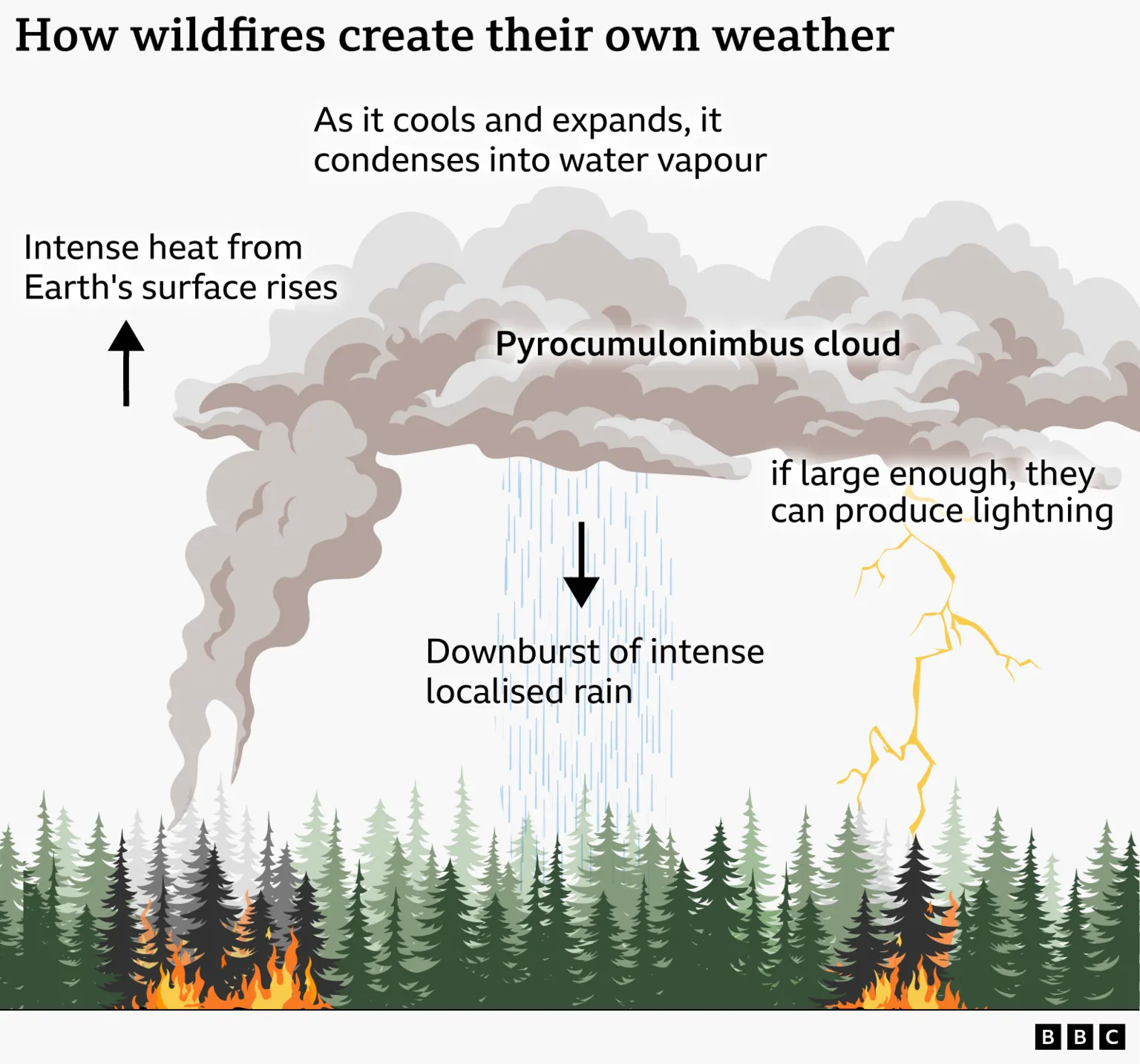
    A graphic shows how wildfires create their own weather.

    These extreme and unpredictable conditions make the fires all the more difficult to stop.

    To combat them, French firefighters have been using planes loaded with fire retardant, as well as planes like the Canadair, which can scoop 6,000 litres of water from lakes or the sea in 12 seconds and drop it directly on the fires.

    On dangerous days, loaded aircraft patrol high-risk areas before any fires have been reported, so they can drop within minutes of a sighting. Planes often fly in a continuous shuttle while retardant is laid along the edges of the fire and ground crews attack the flames directly.

    In Gironde, about 2,500 firefighters, 1,500 military personnel, and 1,200 police officers and gendarmes have been involved in tackling the blaze.

    Around the town of Lacanau, bulldozers, diggers and mechanical shovels have been used to carve a firebreak that is 100m (328ft) wide at points

    A firebreak is essentially a stretch of land that has been stripped of all vegetation to stop the fire from spreading – removing any potential fuel before the fire has a chance to reach it.

    Spanish teams have been using many of the same techniques to tackle their wildfires, which are on course to become the worst the country has seen in two decades.

    Francisco Martin, a government delegate in Madrid, described the fires as “undoubtedly the largest fire in the history of the Madrid region”.

    This summer’s fires have been aided by the hotter, drier conditions caused by climate change, which allow fires to spread faster and burn more fiercely.

    Many on the ground – in both Spain and France – are fearful that the coming week could see worsening conditions, with high pressure forecast to bring dry, settled and increasingly hot temperatures.
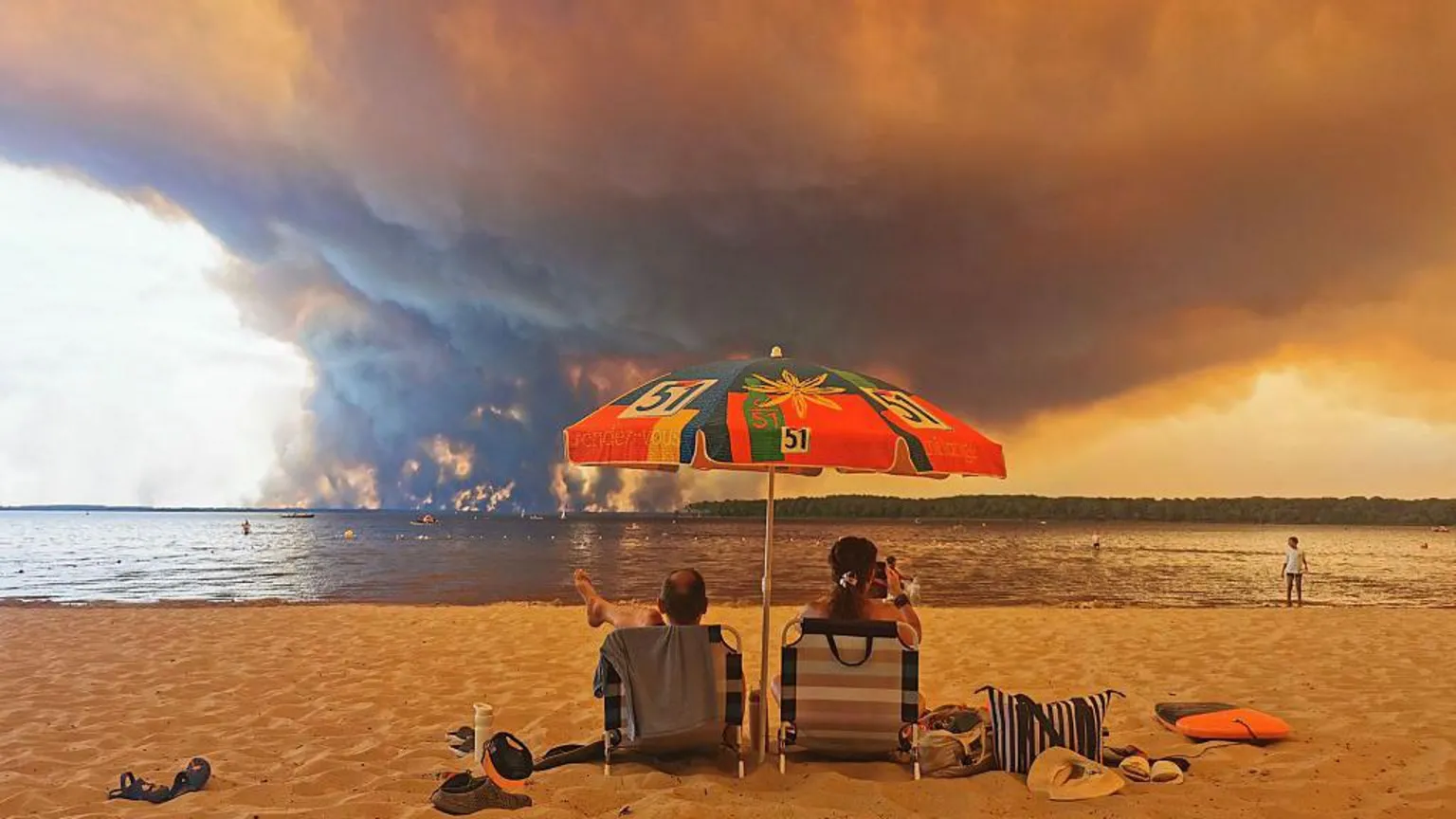
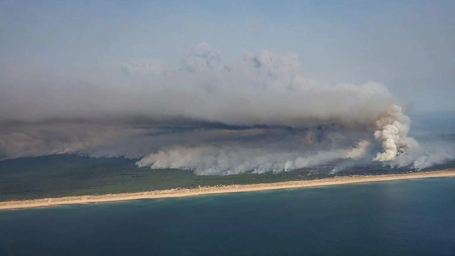
    AFP via Getty Images Beach fire.
    AFP via Getty Images The French wildfires have formed in the Bordeaux area, close to the Atlantic ocean

    The fires near Bordeaux are in an area popular with tourists
    The region also borders the Atlantic ocean

    Additional reporting by Elizabeth Rizzini and Helen Willetts

    France
    Severe weather
    Spain
    Wildfires

    Devastating European maps wildfires
    Share. Facebook Twitter Pinterest LinkedIn Tumblr Email
    Chris Anu
    • Website

    Related Posts

    OneChronos Enters Europe

    July 29, 2026

    Sex assault complaint against on-duty Ottawa police officer under watchdog probe – Ottawa

    July 29, 2026

    Europe Portable Generator Market Size to Attain USD 2.01 Billion by 2035

    July 29, 2026
    Leave A Reply Cancel Reply

    Search
    Latest Post

    MOFA to protest South African ETA system designation

    July 29, 2026

    4 out of 5 American toddler foods are ultra-processed, research says – National

    July 29, 2026

    OneChronos Enters Europe

    July 29, 2026

    Clariant appoints Gapuma Group as Well Service Additives distributor across West Africa

    July 29, 2026

    Why Kenya’s Special Funds Industry Holds Lessons For Africa 

    July 29, 2026

    Subscribe to Updates

    Get the latest creative news from FooBar about art, design and business.

    • Facebook
    • Twitter
    • Pinterest
    • Instagram
    • YouTube
    • TikTok
    ABS TV and ABS Network News is a leading Pan-African 24/7 broadcasting network delivering nonstop news, talk shows, lifestyle programs, and digital media content worldwide through Satellite, Streaming Platforms, and Roku TV.
     
    Based in the United States, we connect Africa to the world while empowering creators, journalists, and brands through innovative media and broadcasting services.
    Facebook X (Twitter) Pinterest WhatsApp Instagram

    Our Picks

    Travel

    MOFA to protest South African ETA system designation

    World News

    4 out of 5 American toddler foods are ultra-processed, research says – National

    Africa News

    OneChronos Enters Europe

    Most Popular

    Features

    Clariant appoints Gapuma Group as Well Service Additives distributor across West Africa

    Trending

    Why Kenya’s Special Funds Industry Holds Lessons For Africa 

    Breaking News

    FG, South Africa hold talks over fresh xenophobic attacks

    © 2026 Copyright. All Rights Reserved by ABSAFRICATV
    • Privacy Policy
    • Terms of Services

    Type above and press Enter to search. Press Esc to cancel.

    We use cookies to ensure that we give you the best experience on our website. If you continue to use this site we will assume that you are happy with it.